全球卫星导航定位技术
时间:2022-09-02 07:29:02
摘要:卫星导航定位系统在国民经济建设中占有重要的位置,是国民经济信息化建设的重要组成部分和推进力量,是建设国家信息体系的重要基础设施,是直接关系到国家安全、经济发展的关键性系统技术平台。以GPS为代表的卫星导航定位(GNSS)应用产业已逐步成为一个全球性的高新技术产业。国家对卫星导航定位产业的发展高度重视,“十五”计划发展纲要确定卫星导航定位为国家高技术工程的12个专项之一,国家发改委在2002年实施了卫星导航产业化专项,以北斗卫星导航试验系统和其他卫星定位导航系统的广泛应用为推动力的我国卫星导航定位产业,正进入高速发展的关键时期。本文介绍了全球卫星导航系统的现状以及分析其原理,并分析了全球卫星导航的发展应用。
关键词: 卫星导航定位系统; 高新技术
Abstract: the satellite navigation and positioning system in the development of national economy, holds the important position, the informationization of the national economy is the important part of the construction and promote the strength, the construction of national information system is the important infrastructure, is directly related to national security, economic development and the key system technology platform. As a representative of the with GPS satellite navigation and positioning (GNSS) application industry has gradually become a global new high technology industry. National satellite navigation and positioning of the development of the industry, more attention of the tenth five-year plan to determine the program for the development of satellite navigation and positioning for the national high technology project of one of the 12 special, the national development and reform commission in 2002, the industrialization of the satellite navigation special to beidou satellite navigation test system and other positioning satellite navigation system for the wide application of driving force of China's satellite navigation and positioning industry, entering the critical period of development. This paper introduces the present situation of the global satellite navigation system and analyzes the principle, and analyzed the development and the application of the global satellite navigation.
Keywords: satellite navigation and positioning system; High and new technology
中图分类号: U666.134文献标识码:A 文章编号
按照定位导航的方式可分成:卫星定位导航、自主式导航、组合导航以及无源导航。
1、全球卫星导航系统介绍
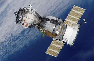
世界上现有卫星导航系统有美国的GPS、俄罗斯的GLONASS以及欧洲GALILEO卫星系统(建设中)和中国的北斗卫星导航(建设中)。
1.1 GPS卫星导航
GPS是美国国防部为军事目的建立的,旨在彻底解决海上、空中和陆地运载工具的导航和定位问题,全部24颗导航卫星(21颗工作卫星和3颗备用卫 星)系统已经建成。GPS采用码分多址(CDMA),定位精度通常15m左右,主要应用于单点导航定位与相对测地定位,具有全天候、定位迅速、精度高、可连续提供三维位置(纬度、经度和高度)、三维速度和时间信息等一系列优点,是实现全球导航定位的高新技术。通常GPS接收机接收到四颗卫星的信号就能够确定移动载体的方位,是当前移动目标导航定位的主流。1992年GPS正式向全世界开放,1994年在中国市场开始得到应用。GPS以精确位置与定时信息, 已成为支持世界范围各种民用、科研和商业活动的一种资源。
1.2 GLONASS卫星导航系统
GLONASS是前苏联研制并为俄罗斯继续发展的全球卫星导航系统,其组成和功能与美国的GPS相类似,可用于陆、海、空等各类用户的定位、测速及 精密定时等。目前已完成了24颗工作卫星加一颗备用卫星空间星座布局,每天24小时每时刻各地的用户可见5~8颗卫星。卫星识别采用频分多址(FDMA),24颗卫星各占一个频率,现已向全世界开放。
1.3 GALILEO卫星导航系统
欧洲为了满足本地区导航定位的需求,计划开发针对GPS和GLONASS的广域星基增强系统(EGNOS),包括地面设施和空间卫星,以提高GPS 和GLONASS系统的精度、完备性和可用性。同时,为了打破目前世界美、俄全球定位系统在这一领域的垄断,欧洲决定启伽利略计划,建立自主的民用全球卫定位系统(GALILEO)。EGNOS是欧洲GALILEO计划的第一阶段,也是GALILEO计划的基础。GALILEO系统将建成全球性的定位和导航系统,它由星座部分、有效载荷、地面监控系统以及区域控制部分组成。GALILEO系统将成为独立性、全球性、欧洲人控制的,以卫星为基础的民用导航和定位系统。其总的战略意图是:(1)建立一个高效的民用导航及定 位系统;(2)使之具备欧洲乃至世界运输业可以信赖的高度安全性,并确保任何未来系统安全置于欧洲人的控制之下;(3)该系统的实施将为欧洲工业进军正在兴起的卫星导航市场的各个方面提供一个良好的机会,使他们能够站在一个合理的基础上公平竞争。
1.4 北斗卫星导航系统
北斗卫星导航系统﹝BeiDou(COMPASS)Navigation Satellite System﹞是中国正在实施的自主研发、独立运行的全球卫星导航系统。北斗卫星导航系统由空间端、地面端和用户端三部分组成。空间端包括5颗静止轨道卫星和30颗非静止轨道卫星。地面端包括主控站、注入站和监测站等若干个地面站。用户端由北斗用户终端以及与美国GPS、俄罗斯“格洛纳斯”(GLONASS)、欧洲“伽利略”(GALILEO)等其他卫星导航系统兼容的终端组成。
